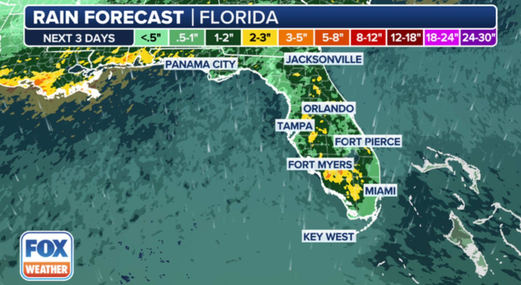
Floridians are gearing up for an unusual weather event as meteorologists issue warnings about “dirty rain” that is predicted to sweep through the Sunshine State this weekend.
A substantial plume of Saharan dust, traveling over 3,000 miles from Northern Africa, is expected to merge with Florida’s typical summer thunderstorms on Saturday and Sunday, creating a blend of dust and rain that could necessitate unexpected clean-up for residents.
“The raindrops, carrying dust particles from the Saharan layer, will result in what’s known as ‘dirty rain,’ leaving a layer of dust on cars, windows, and homes,” reported Fox Weather on Friday.
The Florida peninsula, especially its central and southern areas, is likely to experience the brunt of this dusty downpour. Weather forecasts indicate rainfall ranging from 1 to 2 inches in central Florida, with southwestern regions potentially receiving up to 3 inches. Nevertheless, this rain will not have its usual cleansing effect.

“As a tropical wave approaches and moves northwestward across the state from Sunday to Tuesday, an increase in showers and thunderstorms is expected, with some potentially causing flooding, strong winds, and waterspouts near the beaches,” said AccuWeather lead hurricane expert Alex DaSilva in an online statement.
In the Saharan Desert, where temperatures can exceed 100 degrees for months, dry, hot air lifts fine dust particles high into the atmosphere. These particles are then carried westward by trade winds, embarking on a trans-Atlantic journey that can impact air quality and weather patterns in the Americas.
Florida’s typical weather pattern involves daily thunderstorms, especially on the peninsula, starting near the beach in the morning or midday, moving inland in the afternoon, and dissipating by evening. However, the approaching tropical wave is expected to intensify this pattern.
“The new wave of Saharan dust from Africa has reached Miami this morning. Expect hazier conditions and lower air quality this weekend,” shared meteorologist Brandon Orr from South Florida’s local station WPLG on X, previously known as Twitter, on Saturday morning.
The scale of this dust migration is staggering. NASA estimates that approximately 182 million tons of dust leave Africa annually, with the quantity varying based on rainfall patterns south of the Sahara. The plume is often so massive that it can be observed from space by orbiting satellites.
This “dirty rain” presents several challenges for Florida residents. Apart from the inconvenience of dust-coated vehicles and windows, there are potential health risks, particularly for individuals with respiratory issues, as the fine particles in the air can cause eye, nose, and throat irritation.
However, not all aspects of Saharan dust are negative—the dry air layer it creates over the Atlantic can impede the development of tropical storms.
“Overall, the Atlantic basin is expected to remain calm next week due to extensive Saharan dust and dry air, reducing the chances of tropical disturbances organizing,” as stated on AccuWeather.com by DaSilva.
Moreover, the dust particles in the atmosphere can produce captivating visual effects, potentially leading to breathtaking sunrises and sunsets. The interaction of light with the dust particles can result in striking oranges and reds in the sky.
There could even be an environmental upside, according to Fox Weather. NASA scientists have discovered that the dust contains phosphorus—a crucial plant nutrient. This natural supply of phosphorus could act as a fertilizer for ecosystems, especially in areas where this nutrient is scarce.
