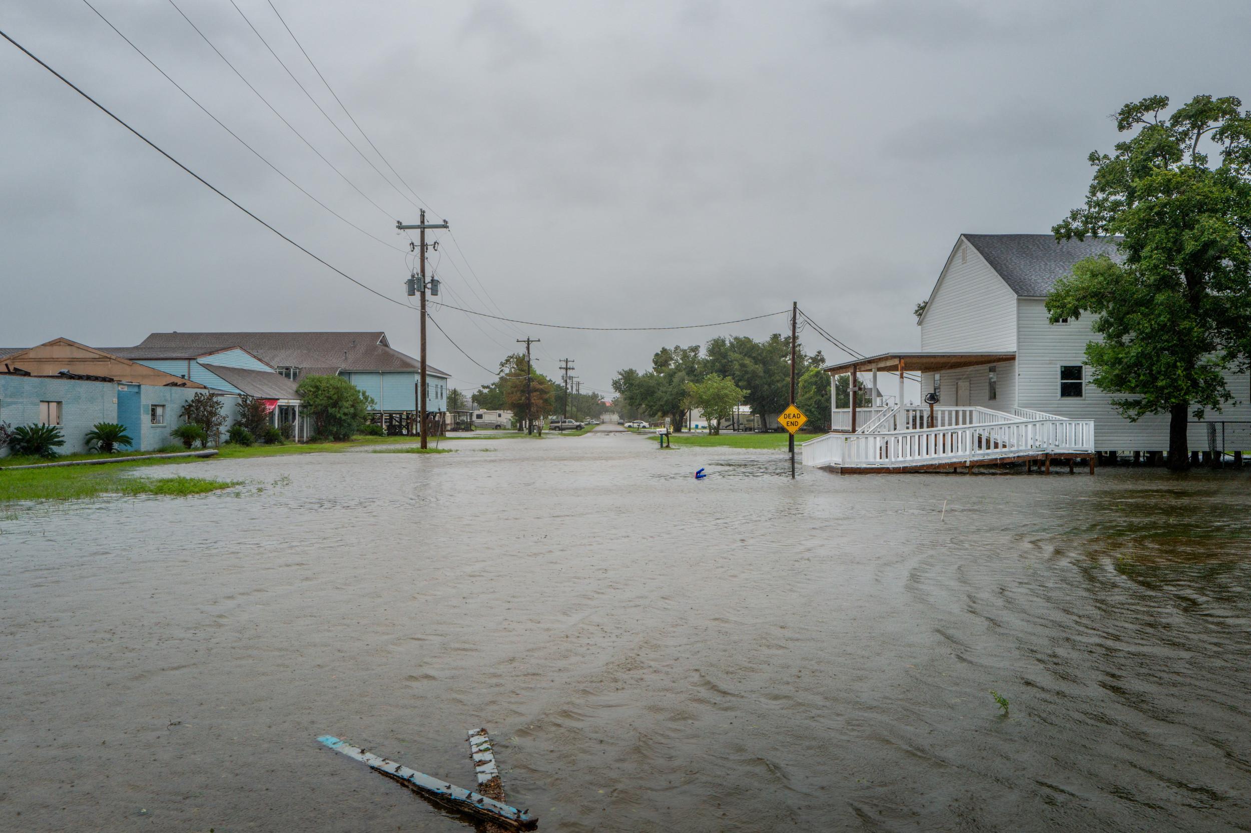
On Wednesday evening, Hurricane Francine made a powerful entrance along the Louisiana coastline, hitting as a Category 2 cyclone. The storm brought with it severe flooding, widespread power outages, and fierce winds that devastated the already vulnerable coastal regions.
The National Hurricane Center (NHC) reported that Francine made landfall near Terrebonne Parish around 5 p.m. EST, with wind speeds reaching nearly 96 mph. By 11 p.m., hurricane-force winds had cascaded into the New Orleans area, where local media documented alarming flash flooding incidents.
In their latest update, NHC experts warned of “life-threatening storm surge” risks along the Louisiana and Mississippi coasts in the hours following the hurricane’s impact. They urged residents to remain safe indoors until the storm’s conditions improved.
Social media was abuzz with videos illustrating the storm’s ferocity, showcasing high floodwaters inundating city streets and the hurricane-force winds uprooting trees and damaging structures. One clip shared by meteorologist Jim Cantore of The Weather Channel depicted him struggling against the punishing winds and rain while broadcasting live from Morgan City shortly after 6 p.m.
Another video recorded by meteorologist Reed Timmer captured a vehicle navigating through New Orleans as the storm swept north. The footage, posted around 8:55 p.m., displayed rushing waters engulfing the road and heavy rainfall obscuring the driver’s visibility.
“This is A Particularly Dangerous Situation,” veteran meteorologist David Bernard commented later in the evening. He stressed that “one of the most significant floods in years is occurring across the New Orleans metropolitan area right now,” mentioning the challenges in assessing the damage due to worsening conditions.
In Morgan City, emergency officials painted a bleak picture of the aftermath as rapid flooding toppled power lines and trees, with the city located roughly 30 miles north of landfall. Fire Chief Alvin Cockerham remarked, “It’s a little bit worse than what I expected. I pulled all my trucks back to the station because it’s too hazardous to operate out there.”

WeatherNation correspondent Erik Fox also shared a video around 8:38 p.m. that showed search and rescue crews working tirelessly in Houma, Louisiana, to locate residents after a structure collapsed under the storm’s intensity.
An article from WDSU later showcased a “good Samaritan” who bravely rescued a driver trapped in a pickup truck by rising waters near a canal underpass. The driver emerged from the back window, with the rescuer wearing a gray outfit pulling him to safety. “The person in the gray rain suit just saved that person’s life,” a WDSU host remarked during the report.
Hurricane Francine is notably the sixth named storm of the 2024 Atlantic hurricane season. Meteorologists had previously indicated that this year might see a higher-than-average number of storms, with the National Oceanic and Atmospheric Administration predicting between 17 to 25 named storms. The Hurricane season runs from June through November each year.
As the storm progresses, it is predicted to traverse northwards on Wednesday night into Thursday, impacting central Mississippi and anticipating continued movement towards Arkansas, Missouri, and Tennessee by Friday evening, as outlined by the NHC’s forecast. Rainfall totals could exceed 4 to 6 inches in parts of Louisiana and Mississippi as the storm maintains its intensity.
The NHC has issued caution regarding a moderate risk of flash flooding through Thursday morning for New Orleans, south-central Louisiana, and extending to Mississippi through Jackson, as they continue to monitor the storm’s path and effects.
