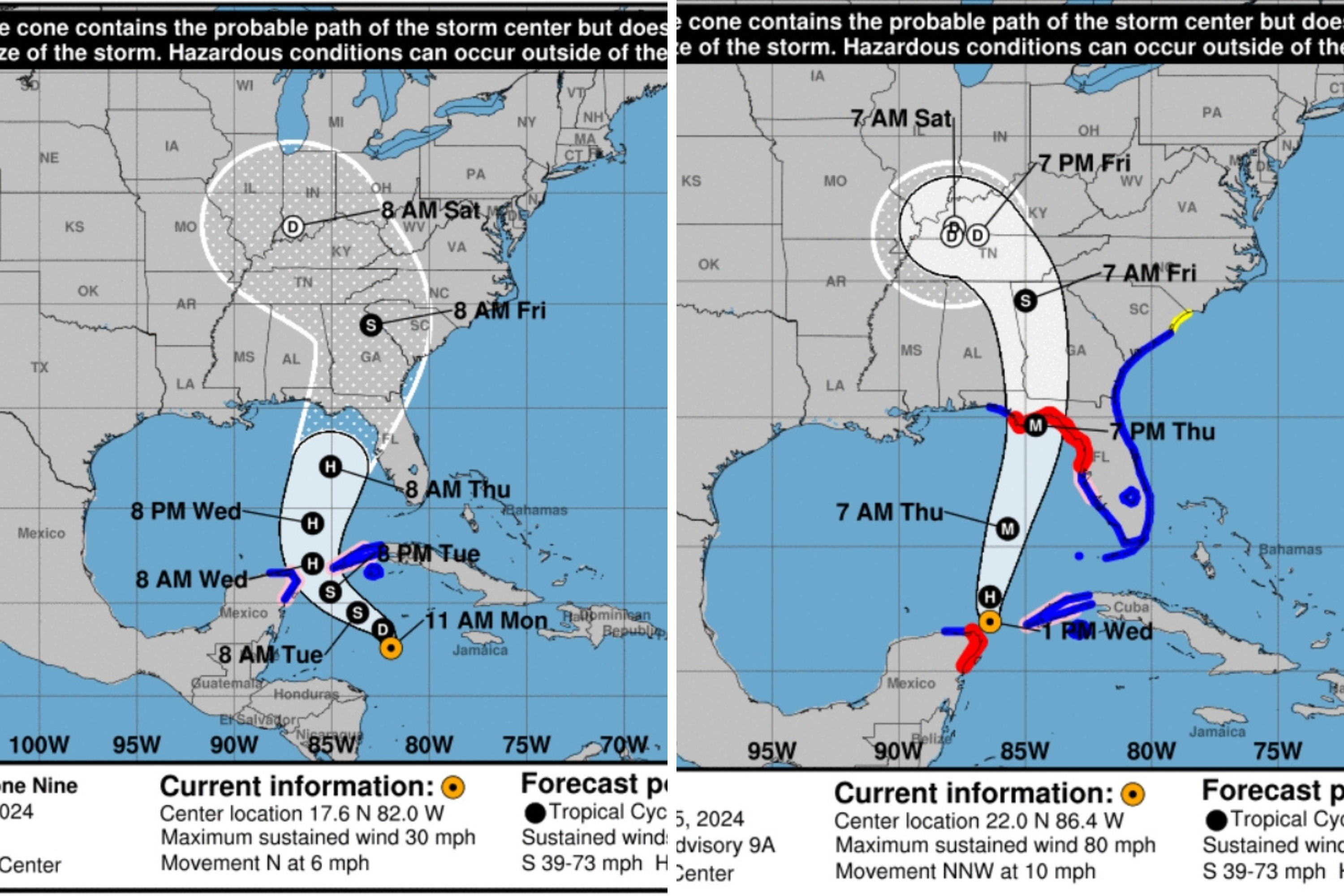
Since the National Hurricane Center (NHC) began tracking Hurricane Helene, its predicted path has become more defined. As of Tuesday morning, Helene was classified as a tropical storm and is projected to make landfall in Florida’s Big Bend region on Thursday night. Several counties are already implementing mandatory evacuations, and the NHC is strongly advising residents to heed these warnings. By Wednesday afternoon, Helene was a Category 1 hurricane with winds reaching 85 mph, but experts predict it could intensify to a Category 3 or higher by landfall.
The forecast for Helene’s course has tightened, indicating its likely trajectory towards Florida. Despite this narrowing, meteorologists caution that the storm could still have extensive effects across multiple states.

Before the NHC updates, there was uncertainty regarding Helene’s path, with some models suggesting a potential landfall in Texas or Louisiana. However, the latest modeling indicates a likely strike between Panama City and Tallahassee as a major hurricane on Thursday night.
Following its landfall, Helene is anticipated to move inland through Alabama and Georgia, with its remnants expected to affect Tennessee, Kentucky, Illinois, and Indiana by the weekend.
The NHC warns of potentially life-threatening storm surges along Florida’s coastline, with some areas possibly experiencing inundation up to 20 feet above ground level. The alert also extends to severe waves along the Big Bend coast.
Numerous weather alerts have been issued for Southern and Southeastern states, including hurricane warnings, tropical storm warnings, and flood watches. States at risk include West Virginia, Kentucky, North Carolina, and Alabama.
Meteorologists emphasize that even areas outside the storm’s direct path should remain vigilant, as hurricanes can lead to widespread destruction. Historical patterns, like the unexpected shift of Hurricane Ian in 2022, illustrate that storm predictions can change rapidly as the system approaches land.
